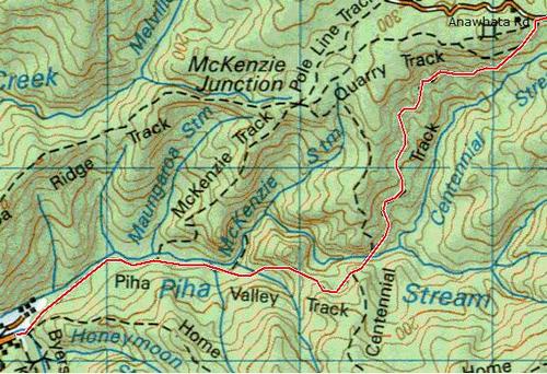
This part of the trail is in three sections. The first section is an abbreviated Fairy Falls Circuit, followed by a short car trip to the start of the Cutty Grass Track, down to the Anawhata Rd, then on down to Glenesk Rd at Piha.
Part 1: The Fairy Falls Circuit
This is one of the jewels of the Waitakeres. The official circuit starts up on the Scenic Drive, heads down to the Falls and up to Mountain Rd, then via Old Coach Rd Track back to the Scenic Drive. Incomprehensibly, this misses out the Goodfellow Track, which is one of my favourites, and in my humble opinion, the westernmost parts of the official circuit do not add a lot to one's experience, and can be safely omitted.
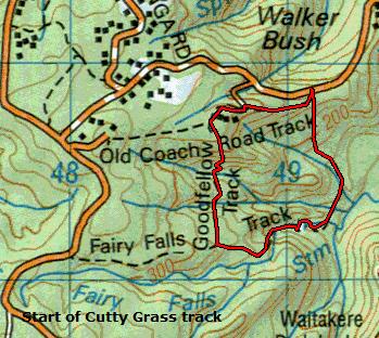
At the Mountain Rd end of the track, there are half a dozen carparks. Head right, up the Old Coach Rd track, a shallow clay V, and you have about twenty minutes of so-so uphill slog before you emerge onto the ranger's driveway.
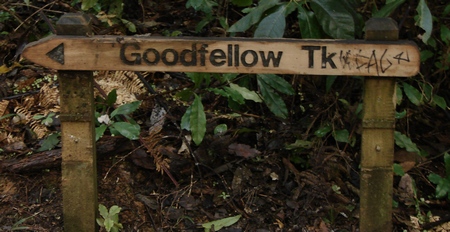
In wet weather, this track can be a touch slippery. The track continues straight across the road and uphill, but if you're like me you will turn left and follow the slightly gentler slope up the drive and around the corner to the ranger's house. Then, just past that you will see the Goodfellow Track heading off to the left.
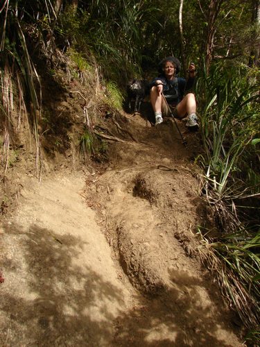
The Goodfellow Track has undergone extensive "motorway" upgrading over the last few years,
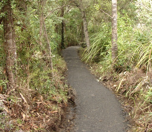
and except for a slightly awkward stream crossing, about three quarters of the way over, you could take your grandmother along it. The surface is gravel, and any steeper sections are accommodated by well constructed steps. The bush is superb, and there are spectacular views out to Auckland city,
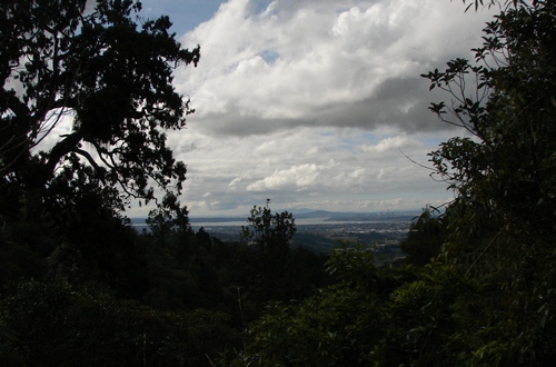
and across the valley. I would always take this track north to south. The climb out on the southern side is easily manageable, whereas climbing up the steps heading north could be daunting if you aren't reasonably fit.
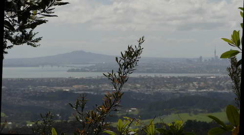
You will emerge on the Fairy Falls Track. Head left, and look out to the left along the way for the quintessential Auckland photo opportunity - you can capture in one photo the Sky Tower, the Harbour Bridge and Rangitoto, all framed in native bush.
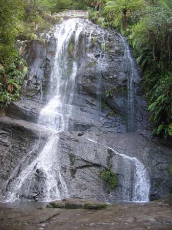
Soon there's a small stream crossing, then a vast descent by millions of steps to the top of the main falls. All down here you can look back at a series of small waterfalls and pools. I enjoy sitting at the base of the falls with a thermos of coffee and just enjoying the sound of them.
Head across the big rock shelf to the other side and follow the track along the stream and up to your car on Mountain Rd. This section of the track is not maintained to the same standard as the section above the falls, but is nevertheless quite easily manageable. There are a couple of stream crossings that in times of very heavy rain may be a problem, but mostly not. In the ordinary way the water will not be deep enough to wet your boots.
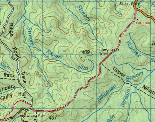
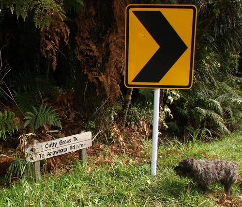
Drive to the top of Mountain Rd, and turn left into Scenic Drive and follow that for a kilometre or so to the start of the Cutty Grass Track on your right.
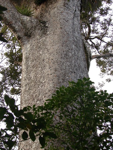
A few hundred metres along here, there's a small unsigned track heading off to the left for about thirty metres to the base of very short, very fat kauri, well worth a look. (Not visible from the main track.)
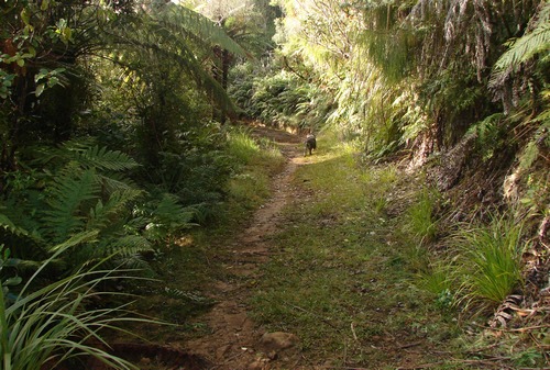
The Cutty Grass Track was originally a service road for the electricity supply to Piha and Anawhata, but today is mostly a mix of gravel and clay. Easy walking, very gently downhill for much of the time, and a rich variety of plants.
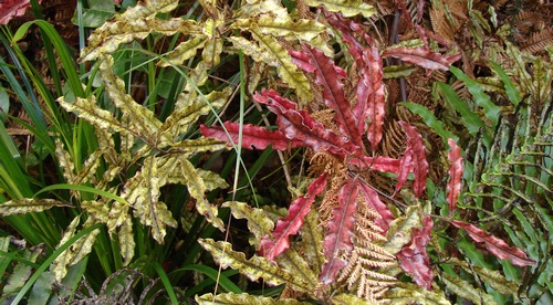
South Islanders who are used to the Westland Quintinia (Quintinia acutifolia) will meet a North Island cousin, Quintinia serrata or Tawherowhero, which I've spotted here and there in the Waitakeres, but on this track it is a major feature, and part of the canopy.
Pass the Ian Wells Track turnoff on the left, and continue on to a clearing that obviously once hosted a house of some sort - pieces of old brick and concrete are all that's left. Just beyond there, a gravel road heads left and meets the Anawhata Rd about 100 metres down. We carry on, and, about 50 metres on, the Ridge Road Track heads off to the right. We continue straight ahead until we reach the Anawhata Rd, then cross to the other side where the McElwain Loop Track begins.
If you've got plenty of time, a short walk up the right hand branch of the McElwain Loop takes you to a lookout over the entire Piha Basin.
Otherwise, take the left hand branch of the loop for a couple of hundred metres, to the junction with the Centennial Track. (I think this was the original signpost - updated recently, I believe.)
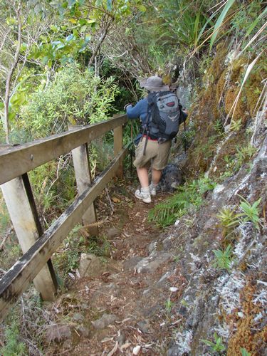
Hang a left onto the Centennial Track. This takes you down the side of a fairly sheer cliff, with interesting views out to the side. You may slow down a little, as it's steep in places, but it's also fenced wherever there's any kind of a drop involved.
Towards the bottom we are joined by the even steeper Forbes Track, and we continue a hundred metres or so to the Black Rock Dam site, the remains of an old kauri dam from the logging days. The Black Rock is up to our right as we look downstream. Here, we cross the stream, and head up the other side. The track we want is the furthest downstream, closest to the dam itself. The other possibilities are dead ends, but you can get lost following them. I know, I have, and wound up bushcrashing along an old poison line.
It's a fairly steep climb for about 5 minutes, over a trail I'd hesitate to describe as anything but rough,
and then we meet the junction with the Piha Valley track, which we follow, along the ridge, and down hundreds of steps, to the McKenzie Track junction and on along the stream to Glenesk Rd carpark, where there are toilet facilities, and you can head back to the Scenic Drive to collect your other car.
If you want to stay the night at Piha, or hang out here for a day or two, check out http://www.piha.co.nz/frame.htm for further information.